Hanoi completes its urban planning, looks to build up a modern green city
Hanoi completes its urban planning, looks to build up a modern green city
The capital city might face challenges in solving numerous issues related to the transport infrastructure, urban public works, and school system.
The capital city of Hanoi has completed 100% of its urban subregions planning projects after over 10 years of implementing the Capital Construction Master Plan by 2030, with a vision to 2050 approved by the Prime Minister.
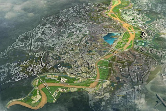
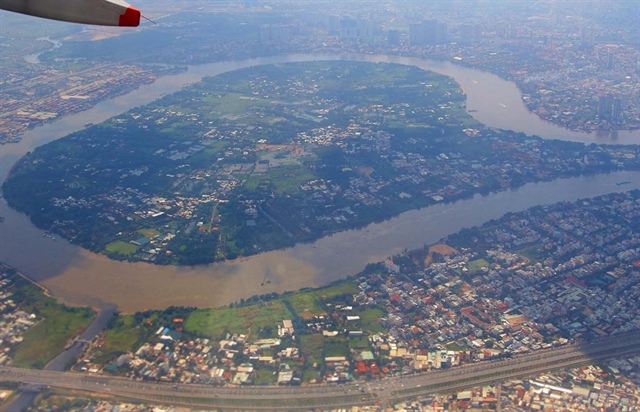
Panorama of the Red River urban subdivision. Photo: The Hanoi Times |
As a result, planning projects on the final six historical urban subdivisions and two others by the Red and Duong Rivers have been included in the master plan.
They are very important for creating a breakthrough in building a green, civilized, and modern capital, to improve livelihoods and quality of life for local people, according to experts and city authority officials.
However, in the implementation of these projects, the city might face challenges in solving numerous issues including those related to the transport infrastructure, urban public works, and school system, they said.
Lack of public works
Deputy Director of Hanoi Urban Planning Institute, Nguyen Duc Hung, revealed some issues in the inner city's historical area in the past recent years including those about the transport infrastructure system which has not been developed synchronously, especially in the western and southern parts of the city such as Ba Dinh, Dong Da, and Hai Ba Trung districts.
The city is also lacking urban public works and school systems to meet standards of development as prescribed in regulations, according to Hung.
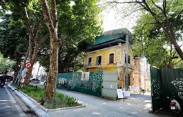
For many years, the historic inner city area consisting of four districts of Ba Dinh, Hoan Kiem, Dong Da, and Hai Ba Trung, has been suffering a lot of pressure in the process of urban development.
The population is growing fast with no more land available for expansion, resulting in traffic jams, environmental pollution, the lack of green spaces, and declined heritage value...
The old quarter in Hoan Kiem District, where located invaluable heritages, now also suffers from serious problems such as poor housing conditions, degraded infrastructure, unattractive urban landscape, and traffic problems.
The six historical urban subregion planning projects covering a total area of over 2,700ha in the four districts were approved and announced by the Hanoi People's Committee at the end of March 2021.
This would be an opportunity for districts to identify construction investment projects, and organize detailed planning and urban design for urban development control and management, the expert said.
“These projects are expected to help upgrade more than 1,500 old dormitory buildings, mainly located in four core districts, which has long been considered a "hardship" for the capital,” Hung said.
Director of Hanoi Department of Planning and Architecture Nguyen Truc Anh said these projects would provide a vital legal basis for detailed planning, urban design, construction management, and forming typical axes of spaces with public works, green parks, cultural and historical zones, tourist and entertainment services as the main functions and symbols of the capital, contributing to promoting socio-economic development, improving people's living conditions in the direction of civilization, modernity, and sustainability.
Meanwhile, Chairman of Hoan Kiem District People's Committee Pham Tuan Long, said the orientation of the approved historical urban zoning projects had been associated with the population expansion that the district implemented for many years.
In addition to the relocation of households living in relic sites, offices and schools carried out by authorities, many people had been proactively moving out, therefore, in the past years, the district population has decreased by 20,000 people.
Along with the urban planning projects in four core districts, the two others to be implemented by the Red and Duong Rivers also play an important role with full meaning in the development of a riverside city. They have just been completed and approved after many years. The Red River with a total length of nearly 120km through many districts is very important to the city's socio-economic development for many generations of citizens.
The approval and announcement of urban zoning projects by the Red and Duong Rivers and six historic urban subdivision planning projects in four districts of Ba Dinh, Hoan Kiem, Dong Da, and Hai Ba Trung created an "overall picture" for the capital city in the direction of civilization, modernity and rich cultural identity of Thang Long - Hanoi, according to Architect Pham Thanh Tung, Chief of Office of the Vietnam Association of Architects (VAA).
"...Thereby, they will help create confidence among people despite many difficulties and challenges still ahead from planning to actual implementation," Tung said.
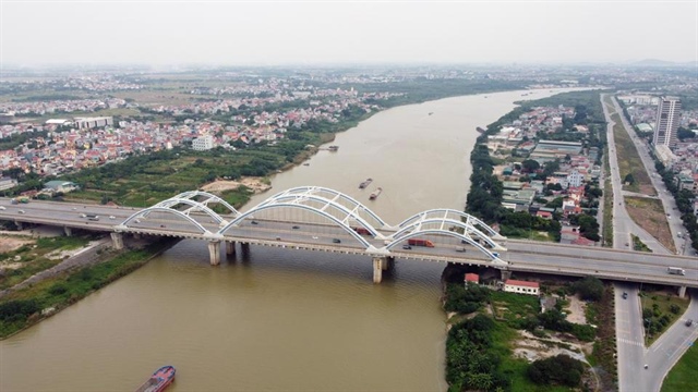
Duong River urban subdivision, section crossing Dong Tru ridge. Photo: Ha Vu |
Renovation of Red River's middle islet
After a project on Red River subdivision planning was recently approved by Hanoi City, districts within the planning scope have actively concretized it with works to serve the community, including a proposal to develop Bai Giua-an islet in the middle of Red River into a cultural and tourist park.
The proposal has drawn special attention and support from local people and experts, many of whom have contributed opinions suggesting that the renovation needs to be carried out following the city's common planning project.
VAA chief of office, Pham Thanh Tung, praised the development of the Red River's middle islet in Hoan Kiem District conveyed many meanings but said it might be associated with the city's common construction, especially the newly approved Red River urban subdivision planning project and the capital construction plan which is being reviewed and adjusted.
Analyzing the advantages gained from the islet renovation and development along the Red River into a cultural and tourist park of the capital, Vice Chairman of the Vietnam Urban Development Planning Association, Dr. Dao Ngoc Nghiem, said that Hoan Kiem District's orientation to research, exploit and effectively promote the land use in and along the Red River bank was worth to be welcomed because it would bring in many benefits.
"First of all, it will help increase the green space in the historic inner city by at least 2sq.m/person from 5.5 sq.m to nearly 8m2/person, reaching the ideal desire of many people. The second is to improve the quality of life for citizens. The third is to meet citizenship demands of entertainment and sports," Nghiem said.
The proposal of Hoan Kiem District is very relevant, showing positivity and dynamism, but a legal basis is needed soon to comply with the general principles of the whole city and the whole country, according to Nghiem.
"In the near future, Hoan Kiem should conduct research and learn from previous related studies and projects. In addition, it must forecast resources and apply science and technology to ensure safety during the implementation process. Another problem is that it should study the traffic connection between the yard area and the traffic system in the inner city. Currently, the connection with the middle beach area is only the boat way down from Long Bien bridge," he said.
Over the recent time, along with a survey on continuously expanding the Red River cleaning projects in the area, Hoan Kiem District People's Committee also aims to develop the Red River's middle islet and the river bank into a cultural and tourist park. Various works have been planned including investments, effective exploitation of the land fund focusing on taking potential and advantages of the natural beauty of the Red River to turn it into a tourist attraction and a landscape axis as well as create open and green spaces with civilized and modern urban infrastructure.
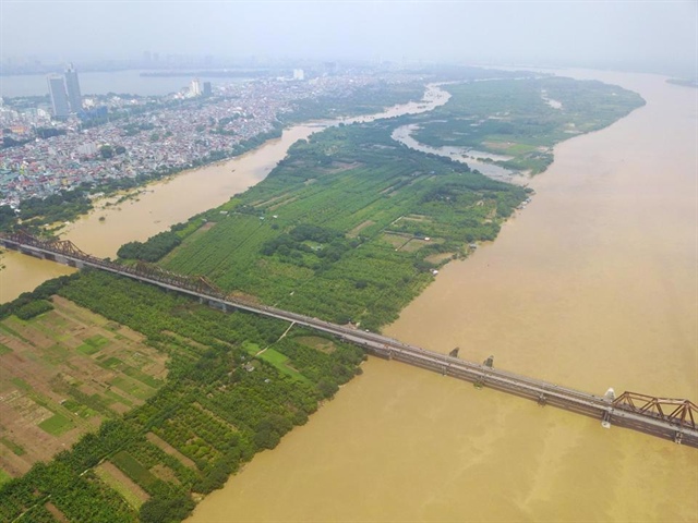
Developing the Red River's middle islet into an entertainment place for people. Photo: Hai Linh |


