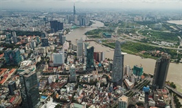
HCM City to develop riverine infrastructure, economy
HCM City to develop riverine infrastructure, economy
HCM City is focusing on developing riverside infrastructure and space for businesses there by 2045. 
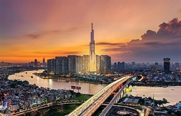
According to a plan submitted to the city's Department of Planning and Architecture, it plans to build multi-purpose infrastructure along the Saigon River, improve the scenery and public utilities there, and reinforce the city’s capabilities in combating flooding, climate change and erosion.
Architect Ngo Anh Vu, deputy director of the HCM City Urban Planning Institute, said the Saigon River’s two banks have 3,100-5,000 hectares of land that could be used to plant trees, build traffic infrastructure and public spaces and provide space for businesses.
The river passes through the city centre, and offers great potential for developing the riverine economy, Nguyen Thanh Nha, the director of the department, said.
Therefore, the areas around it should be prioritised in terms of infrastructure investment, such as embankments, bridges and open green spaces, he added.
Architect Ngo Viet Nam Son, chairman of consulting and design company NgoViet Architects & Planners, said riverside areas could be used to develop public spaces, something the city lacks, and transportation, parking and amusement.
The plan focuses on renovating its banks in the city centre and investing in several key green infrastructure projects.
The investment will focus on areas along the sides which are culturally and historically important and suitable for developing commercially, and those that are connected to infrastructures such as metro lines, roads and bridges.
The city will encourage and help companies invest in green infrastructure.
HCM City has a total of nearly 8,000 kilometres of rivers, canals and channels, accounting for around 16 per cent of its area.


